- 1/1
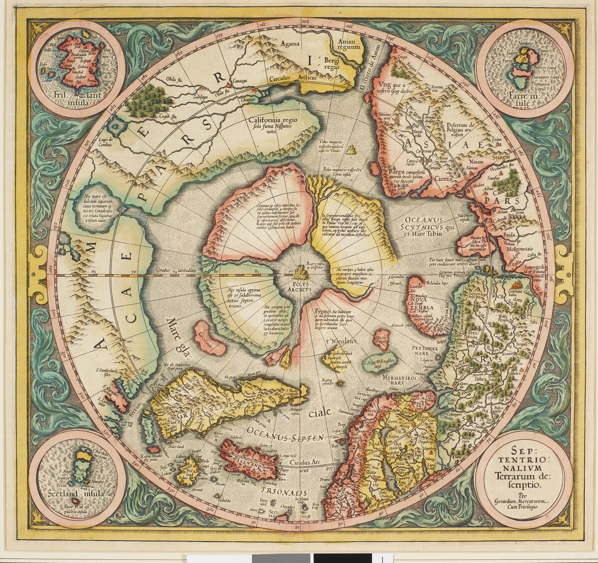
Kart over Nordpolen. Gjenstandsnummer: SVB 10892
Svalbard maps
Svalbard Museum has now cataloged and made the maps and Svalbard banknotes accessible. This means that anyone can view and read about them on digitaltmuseum.no. Choose Svalbard Museum among the collections and enter the word "seddel" or "kart" in the search field.
The map collection is truly unique and consists of maps from the period between 1598 and 1827. The oldest map is the first one where Svalbard is actually depicted on a map. The map was drawn after Willem Barentsz's discovery of Spitsbergen in 1596 and gave the land its descriptive name based on the sharp mountains observed by the explorers. The map itself was printed in 1898 and also shows the route from the Netherlands via Bear Island, Spitsbergen, and to Novaya Zemlya. Another map by the renowned cartographer Mercator depicts the earliest imaginative representations of the North Pole with the west coast of Spitsbergen included.
The early maps only show the west coast of Spitsbergen because the east coast had not yet been explored. On several of these maps, Svalbard is referred to as Greenland because it was not known to be an archipelago but rather believed to be part of Greenland. Several of the maps were pages in world atlases that were published in multiple editions over several years. As new land areas on the globe were explored, the cartographers updated their copper plates and printed new maps. Some of the maps also feature illustrated cartouches and drawings depicting people and animals that were typical of the area. For example, we can see this in map SVB 10898, where whaling is richly illustrated on the sides of the map.
Svalbard banknotes
Svalbard banknotes is a collective term for the notes that circulated on Svalbard from 1916 to 1980, and they were formally considered as payment instruments rather than currency. The coal companies printed their own banknotes, which were used as a medium of exchange on Svalbard. The mining communities were far away from the mainland, and there was a need for money to pay wages and for the use of the miners in purchasing goods and services. The Svalbard banknotes could only be used on Svalbard and were valid for a single season. Each mining company had its own banknotes. In the collection, we have Norwegian, Swedish, and Russian banknotes, as well as some Russian coins. The collection also includes some banknotes that were used during World War II when Svalbard was evacuated, and the population was located on the British Isles. These banknotes bear the stamp of the governor and have been in London. Take, for example, banknote SVB 10785.